Sherrington, Quebec (lower right).
I took a flight out east a while back, from Toronto to Halifax. Being able to watch the world as we move above it is such a thrill for me: rivers, lakes, oceans, forest, farmland, even clouds, the planet is a work of art. Researching later, I learned I not only travelled over picturesque landscape but over dams, canals, tales of treasure, a meteor crater, lake dragons and a memory of an Indigenous hero, towns going back to the beginning of European settlement and rivers paddled by Indigenous peoples, and an island whose history is now its present, as Mohawks finally got restitution for an island appropriated by the Americans after the War of 1812. I loved researching about what I was looking at as much as I love looking at the view.
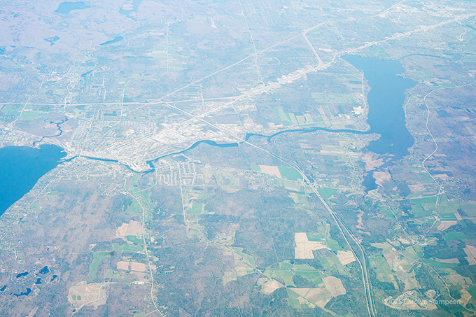
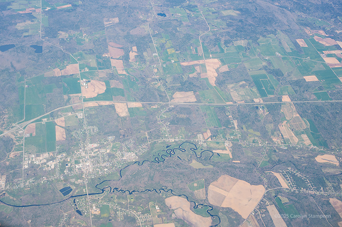
Moira River was originally named the Sagonaska River by the local Indigenous peoples but was renamed by the British in 1807. However, folk in the Belleville area, south of this image, still use Sagonaska in the naming of bridges and schools. To the river’s south, we can see Thrasher’s Corner, and to its north, Plainfield. HWY 37 is running over the river, in the middle of the image, south to north.
Plainfield has a bit of intrigue: “Legend has it that John Meyers, a Loyalist who left New York for Canada and is considered to be the founder of Plainfield, saw two Aboriginal people in a canoe with a large load of silver. Meyers followed them secretly to the Scuttlehole caves. As he followed them they disappeared. It is believed that the silver is hidden somewhere in the caves.”
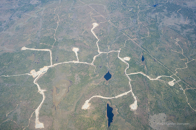
The larger leftmost lake is Napanee Lake, with Pondilly lake to its right. In case one of the names sounds familiar, Napanee, a town to the southwest, not seen in this image, is famous for being the home town of Avril Lavigne. Here, the town southwest of Napanee Lake is Petworth, to its right is Hartington, to its northwest is Moscow, and to its northeast is Verona. The north/south highway to the right is the 38.
A search for information on Petworth brings up information about a ghost town that is finding new life with housing developments. It’s very pastoral-looking from above, obviously with lots of farmland, due in part to or due to 60 years of heavy logging.
Hartington is known for being close to the Holleford meteor crater. Learning this information is one of the reasons that I’ve been finding researching what was under me to be so fascinating, and why this post is so lengthy. I’ve lived in Ontario for some time and did not know about this. It was discovered in the 50s by someone looking at aerial geological survey photos.
Moscow has an interesting history with regards to its name. One might assume a lot of Russian immigrants, but…it was originally named the Huffman Settlement after its original settlers in 1824, then changed to Springfield, but that apparently wrought confusion with regards to the postal system (too many Springfields!), so, in 1854, was renamed Moscow to commemorate Napoleon’s retreat from the Russian city in 1812.
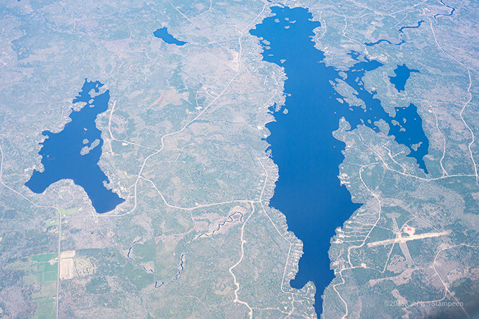
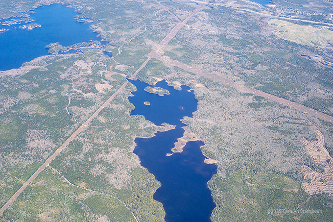
This looks like a land of lakes. Among the ones we can see here are Vanluven Lake, Hambly Lake and Verona Lake to the left, Knowlton Lake in the mid bottom, disappearing out of the scene, Fourteen Island Lake above it, looking dragon-like, and Desert Lake, the large lake to the upper right. Gould Lake is to the lower right.
Knowlton Lake is part of the Cataraqui River watershed.
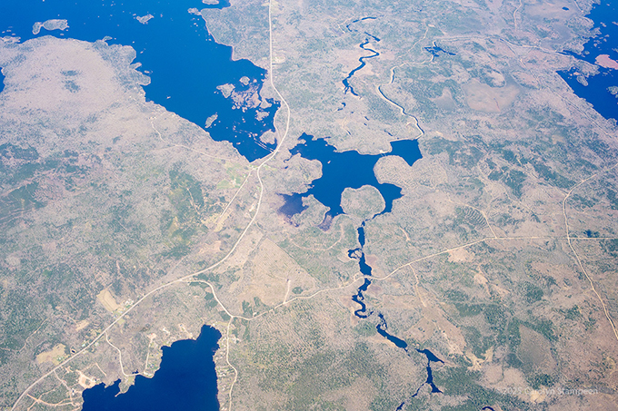
An image on this linked page suggests that the roundish thing near the bottom centre is the Holleford crater. The plane has changed its orientation at bit, but the lakes on the left edge of this image are the same lakes at the right edge of the previous shot. That highway we can see going between the lakes to the left is the same one we see going roughly north/south to the right of the previous image. Another aerial image of the crater can be seen here. I saw a meteor crater! And now, so have you!
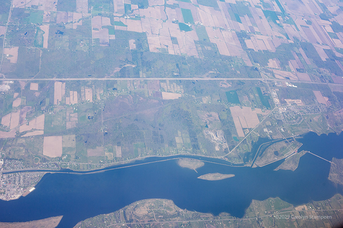
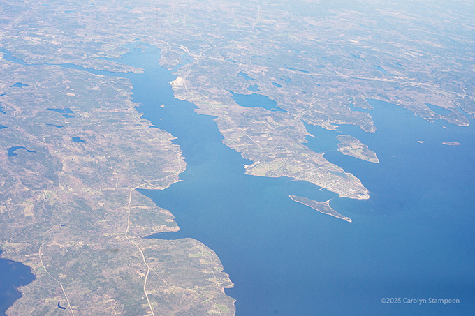
The St. Lawrence River! On this part, it divides Canada and the US. On the north shore is Canada. To the left is Cardinal; to the right, Iroquois. That straight highway at the top is the 401, which runs for 828 km/514 mi, from Windsor, Ontario, to the Quebec border. The highway running along the southern shore is Highway 37, in New York state. That line to the right connecting Canada and the US is the Iroquois Dam, which controls water levels in the river and helps manage levels for the power dams in Cornwall (Canada) and Massena (US), to the east. We can see a red ship at the entrance to the Iroquois Lock, between Iroquois and Harkness Islands, on the north side of the dam.
The big island to the left is Wilson Hill Island, New York, which is an important wildlife management area; to its south, on the mainland, is Louisville. Louisville has a charming history, relevant in these topsy-turvy times: Early American settlers socialized with their Canadian (then British) neighbours, but during the War of 1812, the men of Louisville formed a militia to control traffic down the river. After the war, the Americans and Canadians still crossed the river to socialize, but in secret, at night.
On the north shore is Upper Canada Village, Ontario, a heritage park, and to its left is Aultsville, one of the Lost Villages, which were communities flooded by the creation of the St. Lawrence Seaway. Founded in 1787 by Loyalists, it was flooded in 1958. Before the flooding, its buildings were burned to study the how houses burn. Efficient destruction.
As with the Wilson Hill Island area, part of this area, the Upper Canada Migratory Bird Sanctuary, is committed to migratory birds.
Farther to the right along the north shore is Ingleside, one of the communities built for the relocation of the people of the flooded towns.
Another part of the history of this area is that before the Loyalists moved up from the states, there were already Indigenous settlements here. When the land was carved up and handed out to the Loyalists, no consideration was made for them already being there and they were forced out.
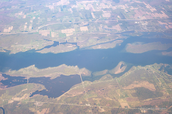
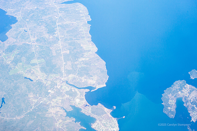
North of the St. Lawrence River here is Cornwall, Ontario; south, Massena, NY. If driving this trip east, Cornwall is where one tries to fill up with enough gas to get by Montreal, which is not a fun place to find gas stations, and Montreal gas tends to be a lot more expensive. Cornwall was first settled in 1784 by Loyalists. During the War of 1812, it was briefly occupied by American troops. Massena was settled in 1792, but “was initially called Nikentsiake by the Mohawk Indians, translating to “where the fish live.””
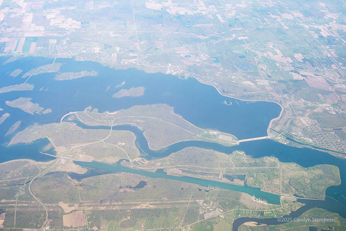
We can see the two power dams, at opposite ends of Barnhart Island, as well as the Wiley Dondero Canal, a 15 km/9.2 mi canal built to bypass and not interrupt the two hydroelectric dams. The Moses-Saunders Power Dam was built across the Long Sault (sault an old French word for rapids) in 1954-58. Previously, this stretch of the St. Lawrence had made navigation a challenge, which inspired the creation of the dams (another new fact for me, as I had thought the St. Lawrence pretty easy sailing). Barnhart Island? Owned by Mohawks, who leased it to British settlers, then was given to Americans at end of the War of 1812. While the Barnharts, the British leasing from the Mohawks, finally saw restitution in 1850 for their financial loss after being forced to pay the Americans to keep their farm, the Mohawks did not see restitution until January 6, 2025.
Another view of the dam and canal, but showing the Long Sault Parkway, those series of bridges connecting eleven islands that are part of Cornwall, Ont. The islands were created during flooding that occurred during the creation of the dams, locks, and canals that help in navigation of the river.
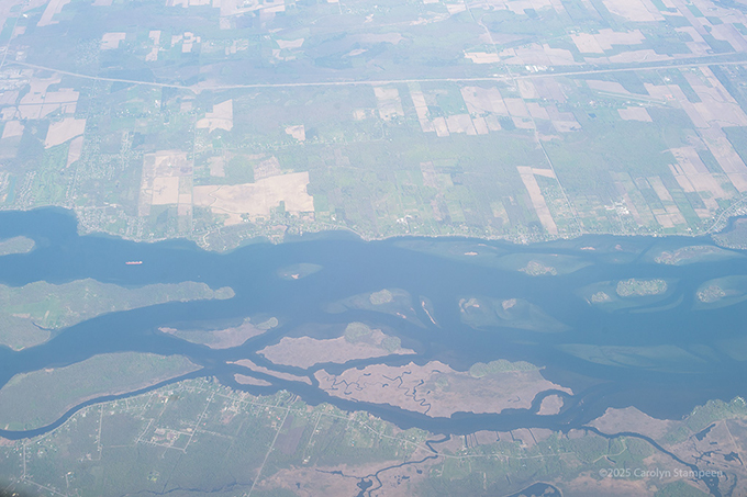
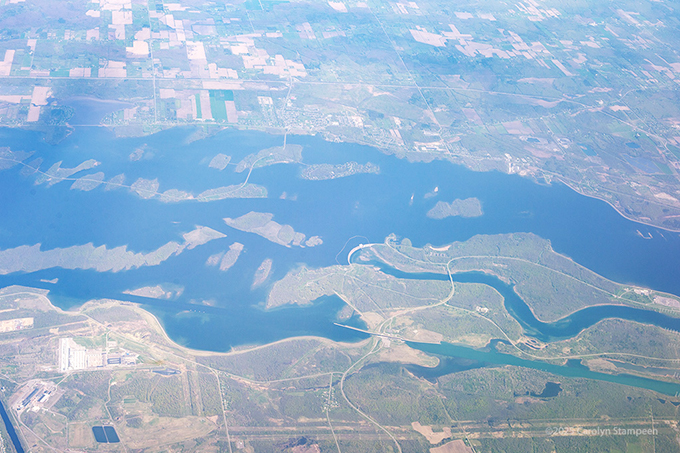
A red cargo ship is navigating between the community of Glen Walter on the north shore of the St. Lawrence and Ile Saint-Regis, the island to the left of the scene. Most of the land south of the St. Lawrence here is part of Canada. It’s south of Ile Saint-Regis that the border stops zipping around the islands in the river and claims land on the south shore for Canada. South of that cool island in the lower middle, Ile Simard, is Akwesane 15, a Mohawk Nation reservation.
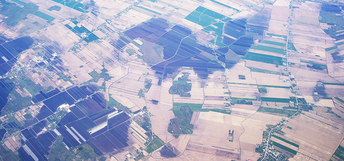
Highway 15 (the thick north/south highway to the left) connecting with Highway 219 (a smaller highway going southwest to northeast) to form eyes staring up at us, to the east of Napierville, Quebec. The European history of this area began in 1799.
Richelieu River in Quebec: it connects the St. Lawrence River to the Hudson River in New York state. First used by Indigenous peoples in their own travel and trading, with the influx of Europeans, it has history of battles between French and Iroquois, French and English, then British and Americans. To the right of the river, where those roads connect, is Sainte-Anne-de-Sabrevois.
This area is noted as the birth place of the 9th premier of Quebec (1887 to 1891), Honoré Mercier.
“He rose to power by mobilizing the Francophone opposition to the execution of Louis Riel, denouncing it as a betrayal by John A. Macdonald‘s Conservative government.”
He opposed Confederation.
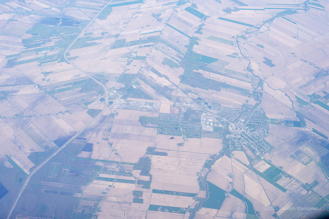
Not far east of the Richelieu River is St. Alexandre, where that highway (HWY 35) curves roughly 90°. The chaos of the farmland looks like an amazing patchwork quilt and the changing angles of the farm plots looks a little bit disorientating, as if the landscape is warping.
Magog, Quebec. Abenaki territory, its first White settlers were Loyalists from Vermont, in 1776. An interesting fact is that the man known as the founding father of Magog, Ralph Merry, was an American Revolutionary who immigrated to Lower Canada in 1799 and started buying up land. He was initially given free land in exchange for an oath of allegiance to the British Crown.
Highway 95 in Maine, with the Stillwater River, a side channel of the Penobscot River, to its right. This is north of Bangor. The 95 is an interstate highway that runs between Miami, Florida, to Houlton, Maine, at the Canada border. It’s 487.63 km/303.00 mi long.
Saponac Pond, Maine. Looking up info with regards to the windmill farm below it, I see there was some controversy with regards to its establishment. Maine Department of Environmental Protection said the farm would destroy the state’s scenic character. In 2013, “Maine’s Board of Environmental Protection voted 5-1…to reverse DEP’s permit denial of a proposed 14-turbine, 42-megawatt wind farm atop Passadumkeag Ridge in Grand Falls Township.”
“The state’s leading environmental agency had rejected the application in November because the array of 459-foot-tall turbines would critically compromise views from Saponac Pond, considered a scenic resource of state and national significance. Analysis concluded the turbines would be visible from 97 percent of the pond, creating an adverse effect on the pond’s character and existing uses dependent upon it, such as fishing, canoeing and kayaking.” Really not sure how the would affect water use…
““It’s not like you can hide them,” Harriman said of the large turbines used in industrial power generation. “I’m not sure what the state of Maine was doing when they decided to go with them. We’re supposed to be Vacationland, not looking at gorgeous mountains with turbines on them. The sight and sound of these turbines is obnoxious,” he said.”
The Passadumkeag Windpark was completed in 2016.
Meddybemps Lake in Maine, close to the New Brunswick border. “Meddybemps has long been recognized as one of the best smallmouth lakes in eastern Maine.”
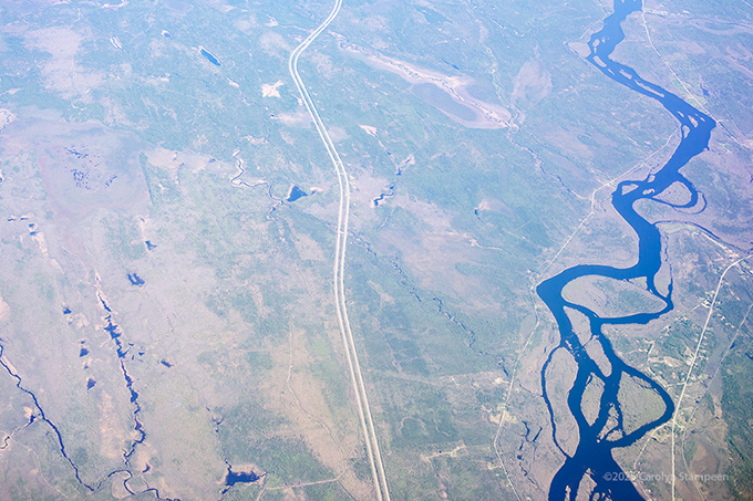
I love how rivers wander through landscape. These rivers remind me of woolly spider webs.
St Andrews, New Brunswick, on that peninsula in the middle, and the Bay of Fundy! St. Andrews was settled in 1783 by Penobscot Loyalists. The site of the town had been named Qunnnoskwamk’ook, meaning “long gravel bar” in the Malecite-Passamaquoddy language, and renamed by a French missionary who happened to land there on St. Andrew’s Day. In 1820, Irish immigrants began arriving. The town is a national historic site of Canada. The island to its left is Navy Island, half of which is owned by the Nature Trust of New Brunswick.
The water to its left is the St. Croix River, which separates Canada and the US. The most noticeable highway we see there is HWY 1 in Maine, on the land to the left.
Pleasant Point is that tip with the two eyes to the right of the land mass to the left, and is part of Maine. The Western Passage separates it from Deer Island, part of New Brunswick, to the right. Deer Island was settled by Loyalists, and The Old Sow tidal whirlpool, off its southern coast, is the largest in the western hemisphere and one of five significant whirlpools worldwide. The Western Passage leads into the St. Croix River.
The St. Croix River was established as a boundary by the Treaty of Paris, 1783, but north of its headwaters took another 4 decades to establish. During the dispute, Maine and New Brunswick kept issuing lumber permits. “With or without a permit, lumbermen were in a race to cut the best timber from the land while it was under dispute. Although it was illegal to cut trees with no permit, the Saint John River enabled this activity because it increased business at the local mills, shipyards and timber ponds in New Brunswick, so the officials were slow to halt the ongoing illegal activity.”
Point Lepreau, New Brunswick. The concrete we see on the point to the left is the Point Lepreau Nuclear Generating Station. It’s the only nuclear generating facility in Atlantic Canada.
We can see a boat on the Bay of Fundy!
The Nova Scotia side of the Bay of Fundy. That’s Eliot Lake making the blue impact. The road going north to south, with the bend in it, up in the right, is Douglas Road, which ends at Port George, which will appear in a future post. The north/south road in about the middle of the image is Mount Hanley Road, and we can see the mountain range over which it passes, which separates the Bay of Fundy coast from the Annapolis Valley. The North Mountain is a volcanic ridge, formed during the Triassic Period, about 200 million years ago!!!
The lower part of the image shows the Valley farmland. The community to the lower right is Brooklyn, in Hants County. It was originally called Nelegakumik by the Mi’kmaq and its post office is officially called Newport. It was settled in 1761 by New England Planters from Newport, Rhode Island. The New England Planters were settlers who responded to the call by the British for settlers to take over land vacated by (vacated as in booted out) the Acadians during the Acadian Expulsion of 1755, and they were the first major group of English-speaking immigrants to Canada that did not come directly from Great Britain.
I’ve grown up with the term Bluenoser and always associated it with the Bluenose Schooner, which is on our dime. However…according to the Planter wiki page, “In Nova Scotia, the New England Planters inspired the provincial nickname of “Bluenoser,” as the term was first used to distinguish Planter candidates from Loyalist candidates in elections after the American Revolution.” Elections can get messy.
The earliest surviving use of the word appears in letters from 1785, in which Rev. Jacob Bailey, a Loyalist, wrote: “The blue noses, to use a vulgar appellation … exerted themselves to the utmost of their power and cunning.”
In another letter, Bailey complained about “violent contentions between the Loyalists and the old inhabitants called blue noses.””
The term “Bluenoser” made it to the Oxford Dictionary in 2013, should anyone ask you.
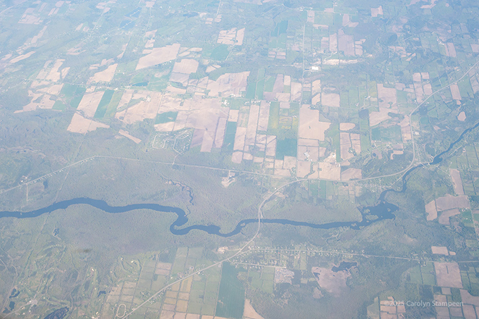
Middleton, Nova Scotia, is the community we see in the lower left. Middleton was settled in the 1750s as the Planters and Loyalists settled lands left vacant by the ousted Acadians. The highway to its north is HWY 101. That is the Annapolis River wending through the lower scene. The part that branches downwards where it forks is the Nictaux River. The Annapolis River was used as a transportation corridor by Samuel de Champlain, who founded the first permanent European settlement in this part of North America, Habitation at Port-Royal, on the north bank of the Annapolis Basin in 1604. The meeting of the Annapolis and Nictaux rivers was a popular fishing spot for the Mi’kmaq, before being settled by the French, then English. Below the Nictaux River is Nictaux, derived from the Mi’kmaq “Niktak,” meaning ‘The forks of a river,’ appropriately enough.
South of Berwick are Lake George, to the left, and Aylesford Lake.
The main highway, wending northwards, is highway 12. The water at the bottom is Murphy Lake and the highway goes between Lockhart’s Cove (left) and Trout River Pond.
Black River Lake, south of Wolfville. Apparently great smallmouth bass fishing.
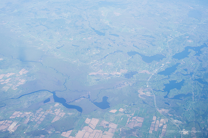
This looks like a petroglyph. The roundish lake in the middle right is Duck Pond and the longer body of water under it is Bennett Lake. This is southwest of Windsor. I’m not sure what this is, but I can see that a proposal for a wind farm southwest of Windsor was made in 2023. Information on the Benjamins Mill Wind Project puts it in the right area, and this is a partnership with a Mi’kmaq company owned by the 13 Mi’kmaw bands in Nova Scotia. If they are on schedule, they are beginning to put up the turbines now.
Panuke Lake, southeast of Windsor. Panuke Lake Nature Reserve, along its shores, is owned by Bowater Mersey Paper Company Limited. “The reserve protects an old-growth eastern hemlock-red spruce forest, a remnant of a once-common forest type in Nova Scotia.”
“South Panuke Wilderness Area protects significant portions of the Canaan and East River watersheds, including lake and stream habitat for brook trout and potential Atlantic salmon recovery. It also fills a significant gap in representation of the South Mountain Rolling Plain natural landscape in the provincial protected areas network.These lands are part of a traditional Mi’kmaq travel route between the Bay of Fundy and Atlantic coast.”
To its right is St. Croix 34, a Mi’kmaq reserve.
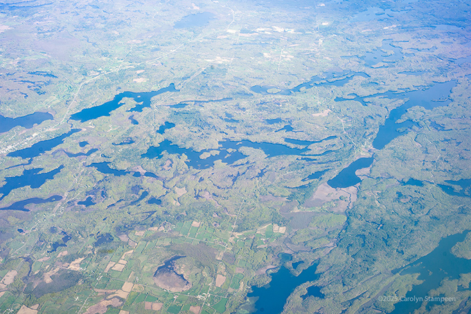
Big Pine Lake. To the north we see a wind mill farm, part of the Ellerhouse 3 Wind Project. Lots of these have sprung up in the province. Highway 101 runs along the top.
Haverstock Island in Pockwock Lake, to the east of Upper Sackville. Pockwock Lake is the main drinking water supply for Halifax, Bedford, Sackville, Fall River, Timberlea, and Waverly. The surrounding wilderness area protects a third of its watershed.
Tomahawk Lake, with Pockwock Lake in the upper left. This lake is being managed as a future expansion to Halifax’s drinking water.
McCabe Lake, to the west of Lower Sackville.
That body of water we can glimpse in the lower right is Jack Lake. The grey to the upper left is a Nova Scotia Power Sackville Substation. This is just north of Bedford.
That is still Jack Lake, and this is another look at some of that scarring seen in the right of the previous image. This was the hardest thing to identify. That road we see in the upper corner is called Rifle Range Lane, and if I have this right, after reading many web pages trying to figure out what kind of quarry this is, I finally believe it is the DND Bedford Range. This site identifies the area as “The Bedford Rifle Range is an operational, outdoor Canadian Armed Forces (CAF) small arms range located within the Halifax Regional Municipality. The 250-hectare property provides a safe, controlled area in which CAF personnel and authorized law enforcement agencies can receive qualification or requalification training for safe use of small arms (weapons designed for individual use). This range does not conduct any experimental testing of new weapons or ammunition for the Department of National Defence (DND).”
And this page talks about Nova Scotia Rifle Association having a partnership with the DND, showing construction of some of their ranges, which would explain why this looks quarry-like from above. The range seems to continue north of this image.
“From 1980 to 2013, six Canadian Forces (Regular and Reserve) marksmen from Nova Scotia have won the prestigious Queen’s Medal for Champion Shots seventeen times in national Service Rifle competitions.” Go figure.
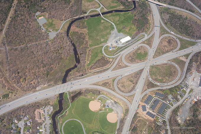
North of Bedford, HWY 101 meets HWY 102.
That’s Robert Lanihan Baseball Field and the Bedford Skate park near the bottom and the river running through is the Sackville River.
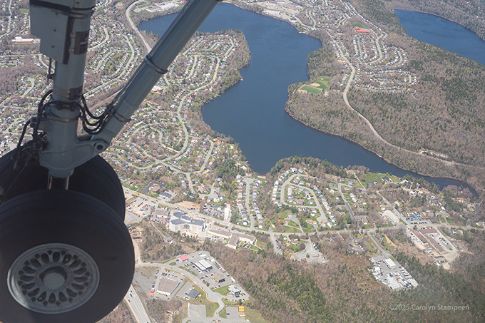
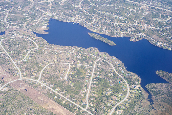
Wheels go down over Lower Sackville! That’s the creatively-named First Lake, with Second Lake in the upper right, and, there is a Third Lake. These are part of Sackville Lakes Provincial Park. With regards to the naming, I was laughing when I saw naming of some lakes in Maine (these are only some of my photos), but then I got to identifying these lakes, and, well, judge not…
The aforementioned Third Lake is at the top. At the bottom is Three Mile Lake.
The 102 is crossing Lake Thomas, north of Waverly.
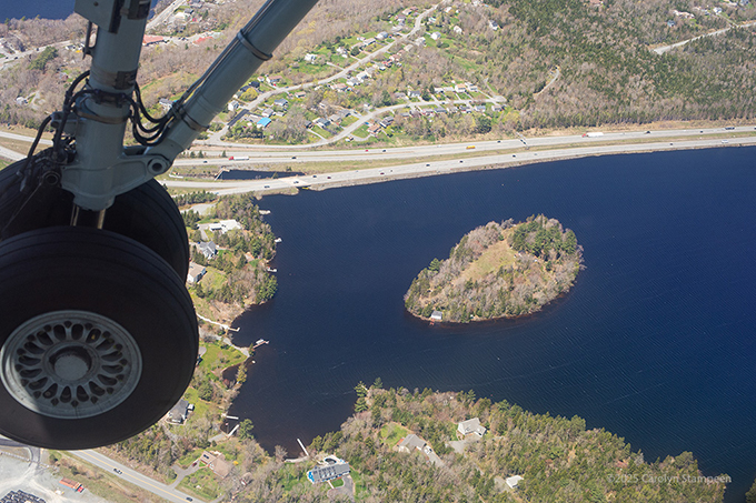
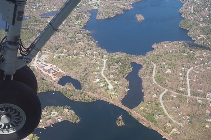
Lone Cloud Island sitting in Millar Lake, with the 102 running along its north shore. This little, unassuming island, has a wonderful story. It was named after Chief Jerry Lonecloud, described as an entertainer, ethnographer, Chief Medicine man of the Nova Scotia Mi’kmaq, author of the first Mi’kmaq memoir. His history starts with the Union Army, his father being one of the men who apprended John Wilkes Booth after the Lincoln assassination, then mysteriously disappearing after he presented himself to claim his share of the reward; the “Buffalo Bill Wild West Show;” and he experienced the devastation of the Halifax Explosion in 1917. He died in 1930.
Boy Scouts Canada purchased the island in 1926 for a summer camp.
Millar Lake has been known for a sea monster since the 50s. Initially, it was a log that looked like a sea creature, then the community embraced having a dragon amongst them. In the 70s, Emily took her place in some iteration. She disappeared for a time, finally being found in New Glasgow, 130 km away. She had replaced another dragon that had also disappeared. She got a friend, Dillon, who had GPS trackers embedded should any more shenanigans take place. Look out for sea dragons when you drive to the airport.
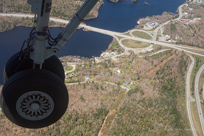
Soldier Lake. We are close to landing!
Holland Brook. Halifax Stanfield International Airport (YHZ) is off screen, to the upper right, and that wraps up this part of the adventure, beginning a new one.
By the way, this airport was part of Operation Yellow Ribbon. Canada immediately stepped during the horror of 9/11. After the US grounded all aircraft and closed its airspace, “Canada’s goal was to ensure that potentially destructive air traffic be removed from United States airspace as quickly as possible, and away from potential U.S. targets, and to instead place these aircraft on the ground in Canada, at military and civilian airports primarily in the Canadian provinces of Nova Scotia, Newfoundland, and British Columbia. Yukon, New Brunswick, Alberta, Manitoba, Ontario, the Northwest Territories, and Quebec also took in aircraft so that any malicious or destructive potential threats could be better contained and neutralized. None of the aircraft proved to be a threat, and Canada hosted thousands of passengers who were stranded until U.S. airspace was reopened.” 225-240 aircraft were diverted to 17 Canadian airports.
Recent Comments